The Mount Royal Montreal residents actually use is less a tourist sight than a back garden: joggers on the switchbacks at 06:00, drummers at the foot of the slope on Sunday afternoons, skaters at Beaver Lake in January, and a crowd at the Kondiaronk lookout every clear evening of the year. It is a 200-hectare park designed by the man behind Central Park, it is free, and you can walk up from downtown in half an hour. Below: how to get up the mountain, which lookout to choose, what is closed for works in 2026, how the park changes with the seasons, and the other parks, beaches, islands and canal paths that make Montreal one of the best big cities in North America for getting outside.
If You Only Have a Few Hours
- Two hours: climb from downtown to the Kondiaronk Belvedere for the skyline view, then drop down the other side to Beaver Lake and catch the 11 bus to Mont-Royal metro.
- A Sunday afternoon in summer: go to the tam-tams at the foot of the mountain on avenue du Parc, then walk up chemin Olmsted.
- A fine autumn day: Mount Royal in mid-October, then the cemetery paths of Notre-Dame-des-Neiges for the colour without the crowds.
- A hot summer day: the Lachine Canal by BIXI bike, or Parc Jean-Drapeau on the Yellow line.
- A winter day: skates or snowshoes from the Beaver Lake pavilion.
- A slow morning with coffee: Parc La Fontaine in the Plateau, then brunch nearby.

Mount Royal Montreal: The Park at a Glance
Montreal is named after its mountain, and the city has grown around it rather than over it. At 233 metres above sea level at its highest point, Mount Royal is, frankly, a large hill. It is one of the Monteregian Hills, a line of old volcanic intrusions that rise out of the flat St Lawrence plain, and it has three summits: the one with the cross, the Westmount summit to the west, and the Outremont summit where the Université de Montréal sits.
The park itself covers about 200 hectares of the mountain’s slopes and top. It was designed by Frederick Law Olmsted, the landscape architect of New York’s Central Park, and inaugurated in 1876. Olmsted wanted visitors to feel they were climbing a real mountain, so he designed a long, winding carriage road with gentle gradients and views that open up gradually, rather than a straight path to the top. That road, chemin Olmsted, is still the main walking route.
| Mount Royal Park | Detail |
|---|---|
| Size | About 200 hectares |
| Designed by | Frederick Law Olmsted; inaugurated 1876 |
| Highest point | 233 m above sea level |
| Entry | Free |
| Nearest metro | Mont-Royal (Orange) for the 11 bus; Peel (Green) or Place-des-Arts (Green) to walk up |
| Main lookout | Kondiaronk Belvedere, facing downtown and the river |
| Parking | Five paid lots: Beaver Lake pavilion, Maison Smith and the Camillien-Houde lookout |
| Managed with | Les amis de la montagne, the non-profit that runs programming and publishes current conditions |
A long-standing planning principle keeps downtown’s towers from rising above the mountain, which is why Montreal’s skyline looks relatively modest from the lookout and why the mountain still dominates views from the east and north. You’ll notice the effect most from the Kondiaronk Belvedere, where you look down on the tops of the tallest buildings.
What’s Closed on the Mountain in 2026
Most guides describe Mount Royal as if nothing ever changes up there. In 2026 some of it has. When we checked the park’s official site in September 2026, Les amis de la montagne reported that:
- The Mount Royal Chalet, the big 1930s pavilion behind the main lookout, is closed during excavation work on chemin Olmsted.
- Access to the Kondiaronk Belvedere is hindered by construction, though the lookout can still be reached on foot.
- The southwest slope, the side facing downtown, is being redeveloped in a project running until spring 2027, to deal with heavy foot traffic and invasive plants and to improve access from downtown.
In practice, you can still reach the view. Walk chemin Olmsted to the summit or take the stairs midway along it, or climb from the entrance at rue Peel and avenue des Pins, where stairs lead up to the lookout. Expect fences, detours and the odd closed path, and check the conditions page on the morning you go, since the works move around. Toilets and the café in the chalet won’t be available while it is shut, so bring water.
How to Get Up Mount Royal
There are four sensible ways up, and which one suits you depends on where you start and how much climbing you want.
| Route | Start | Effort | Time to the lookout | Best for |
|---|---|---|---|---|
| Peel stairs | Rue Peel at avenue des Pins, downtown | Steep: a few hundred steps | About 20–30 min | Fit walkers staying downtown |
| Chemin Olmsted | George-Étienne Cartier monument, avenue du Parc | Gentle, long switchbacks | About 45–60 min | A proper walk; families; Plateau visitors |
| Bus 11 | Mont-Royal metro (Orange line) | None, then a short flat walk | About 20 min ride plus 10–15 min walk | Limited mobility, bad weather, small children |
| Car | Paid lots at Beaver Lake, Maison Smith or Camillien-Houde | None | 10–15 min walk from Maison Smith | Visitors with a car already |
Walking up from downtown
From downtown, walk north up rue Peel (Peel metro on the Green line is the nearest station) until it ends at avenue des Pins. Cross, and you are at the park entrance. Stairs climb through the woods to chemin Olmsted, and a second flight takes you up towards the chalet and the lookout. It is the quickest way up and it is steep: you’ll feel it in your legs, and in winter the stairs can be icy. Because the southwest slope works run until spring 2027, look out for signed detours near the bottom.
Chemin Olmsted from avenue du Parc
This is the walk Olmsted intended. Start at the angel-topped George-Étienne Cartier monument on avenue du Parc, opposite Parc Jeanne-Mance, and follow the wide gravel road as it zigzags gently up through the forest. It is long but never steep, which makes it popular with runners, families with pushchairs and anyone who would rather talk than pant. It passes a turn-off with stairs that shortcut the last switchbacks, and the whole climb at an easy pace takes under an hour. From the Plateau, this is the obvious route.
The 11 bus
STM bus 11 runs from Mont-Royal metro on the Orange line up over the mountain on chemin Remembrance and down the other side towards Côte-des-Neiges. Get off near Maison Smith or Beaver Lake: from Maison Smith, the lookout is a mostly flat 10 to 15 minutes’ walk along the paths. It is the easiest way to reach the top, and it lets you walk the scenic way down, which is how we’d do it with children. A single fare is $3.75, or tap in with a day pass.
Accessibility
With the bus or a car, most of the summit area is reachable without stairs: the paths between Maison Smith, the chalet area and Beaver Lake are broad and fairly level, and each paid parking area has one or two reduced-mobility spaces. The Peel stairs are not an option for wheelchair users, and during the current works some surfaces are rougher than usual, so check conditions first.
The Lookouts
Mount Royal has several viewpoints, and they face in completely different directions. Pick according to what you want to see and when.
Kondiaronk Belvedere
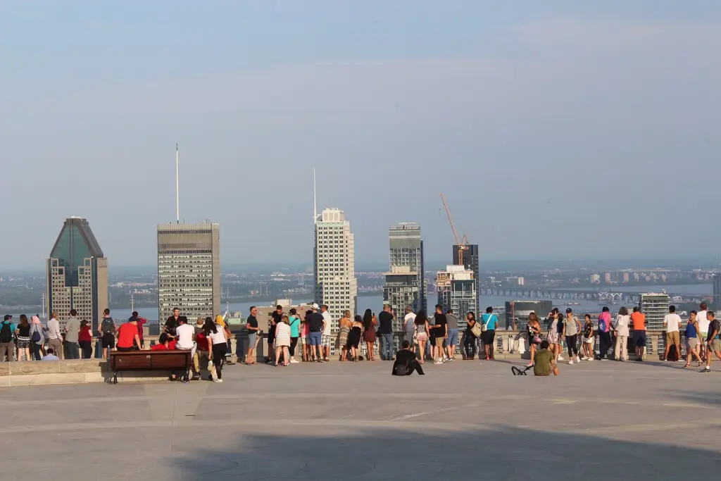
This is the view on the postcards: downtown’s towers straight ahead, the St Lawrence behind them, and on a clear day the Monteregian Hills rising out of the plain beyond the South Shore. The broad stone terrace in front of the chalet is named after Kondiaronk, the Huron-Wendat chief whose diplomacy was central to the Great Peace of Montreal in 1701.
It faces south-east, so it is best from late afternoon, when the sun is behind you and the buildings light up, and after dark, when the city glows. It is at its most crowded at sunset on summer weekends. For a quieter experience, go on a weekday morning.
Camillien-Houde lookout
On the eastern side of the mountain, beside the road and one of the paid parking areas, the Camillien-Houde lookout faces east over the Plateau, Rosemont and the Olympic Stadium. It is the viewpoint for sunrise and for getting a sense of how far the city spreads beyond downtown. Because you can park right beside it, it is also the one most people with cars end up at.
The Westmount summit
The small Summit Woods park on the Westmount summit has a lookout facing north-west towards Saint Joseph’s Oratory’s great dome and, beyond it, the Laurentians on a clear day. It’s in a quiet residential area and sees a fraction of the visitors, which is exactly its appeal. Combine it with a visit to the Oratory and the other big sights on the Côte-des-Neiges side.
Is Mount Royal Montreal’s best free view?
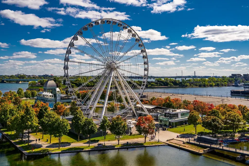
For a first-timer, yes. The Kondiaronk Belvedere beats anything you can pay for: the observatory at the Montreal Tower in Olympic Park is closed until spring 2027, and the former Au Sommet observation deck at Place Ville Marie no longer operates. The Grande Roue ferris wheel in the Old Port gives a different view, of the river and Old Montreal, but it costs $29.50 plus tax and sits much lower. Go up the mountain first.
The Cross, the Chalet and the Summit
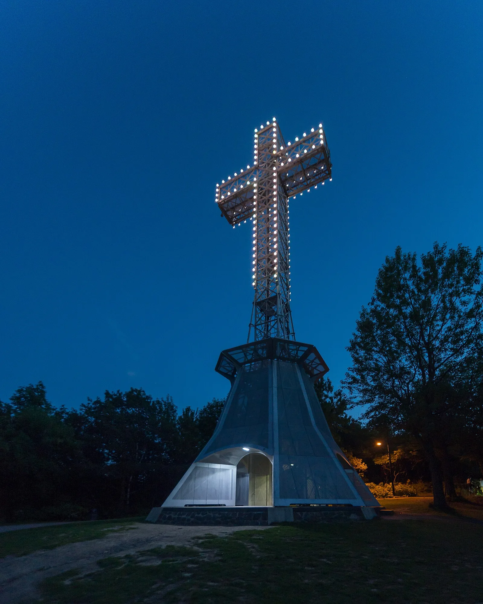
The illuminated Mount Royal Cross stands above the lookout on the eastern summit and can be seen from much of the city at night. The current steel cross dates from 1924, but it commemorates a much older one: in 1643, Paul de Chomedey de Maisonneuve, Montreal’s founder, carried a wooden cross up the mountain in thanks after the young settlement was spared from a flood. You can walk up to the base of the cross in about 15 minutes from the chalet along the summit paths.
The Mount Royal Chalet, built in the early 1930s, is the large stone pavilion behind the Kondiaronk terrace, with a vaulted hall and paintings of Montreal’s history around its walls. It is normally open to walk through, with toilets and water, but as noted above it is closed during the current works. Nearby, a small plaza has been created to mark the mountain’s natural summit.
Maison Smith, a 19th-century house in the middle of the park, is the base for Les amis de la montagne and is used for visitor services and exhibitions about the mountain. It was closed for restoration through 2025; check its status before you plan around it.
Beaver Lake (Lac aux Castors)
Despite the name, there are no beavers. Beaver Lake is a small artificial pond on the flatter north-western part of the summit, built in the late 1930s on what had been marshland, and it is where Montreal families come to spend an afternoon. Lawns slope down to the water, there are picnic spots and a play area, and the modern pavilion beside it has a café and, in winter, equipment rentals.
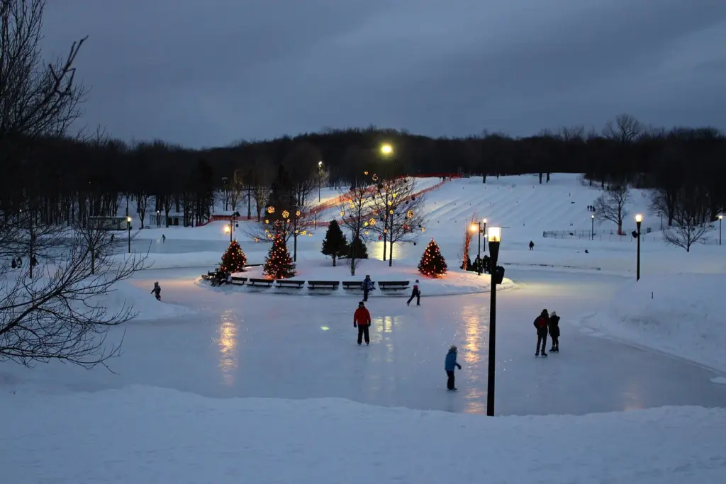
In summer you can rent rowboats and play outdoor games. In winter the lake becomes the mountain’s skating spot, with a refrigerated outdoor rink that holds good ice even in milder spells, plus a sliding hill for snow tubing nearby. Two of the park’s paid parking areas are beside the pavilion, and the 11 bus stops close by. It is the best place on the mountain for small children, and far less of a slog than the lookout for anyone who struggles with hills.
The Tam-Tams
Every Sunday afternoon from May to September, drummers gather around the George-Étienne Cartier monument at the foot of the mountain on avenue du Parc, and a crowd gathers around them. It started informally in the late 1970s and has become a fixture: hundreds of people drumming, dancing, selling crafts, juggling, slacklining between trees and lying on the grass with friends. Up the slope behind, groups often stage mock medieval battles with foam weapons.
There’s no stage, no programme and no ticket. Turn up from early afternoon on a sunny Sunday, bring something to sit on, and stay for as long as you like. It is at its best in June and July, and it is one of the few things in Montreal where tourists and locals mix completely. The nearest metro is Mont-Royal or Place-des-Arts, then a walk or bus up avenue du Parc, and the Plateau’s cafés and bakeries are a few blocks east. Our neighbourhood guide covers the area.
The Cemeteries on the Mountain
Two large cemeteries occupy much of the mountain’s northern slope, and they are among the most beautiful green spaces in the city. Visitors are welcome to walk their roads and paths, provided they remember where they are: keep your voice down, stay off the graves, and give way to funerals.
Notre-Dame-des-Neiges
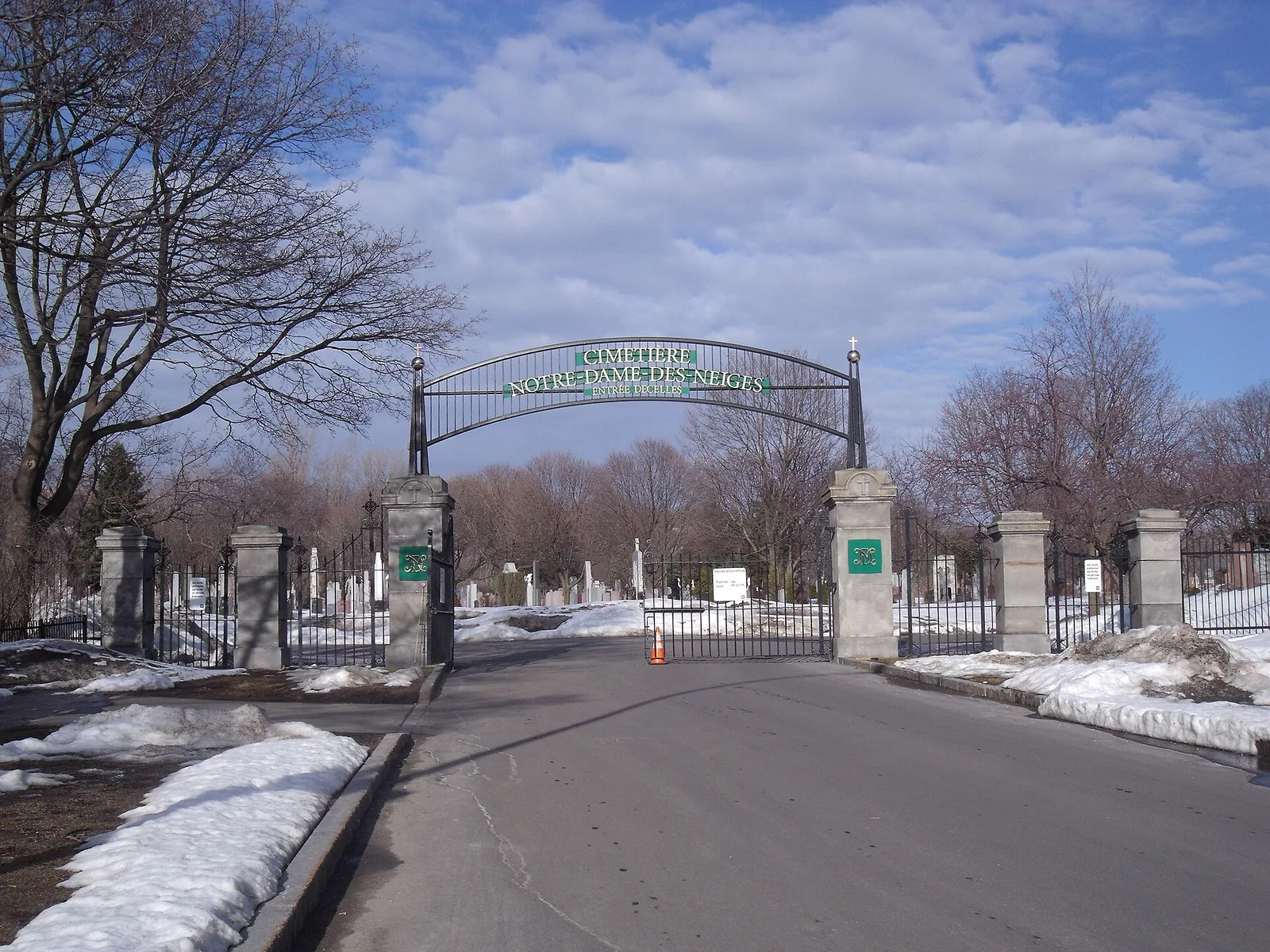
Founded in the 1850s, Notre-Dame-des-Neiges is the largest cemetery in Canada and the principal Catholic burial ground in Montreal. Its roads wind through old trees and grand family monuments, with views across the city’s north. It is at its finest in October, when the maples turn, and it is a good choice if the main park paths are busy.
Mount Royal Cemetery
Next door, the Protestant Mount Royal Cemetery opened in 1852 and was laid out as a garden cemetery, with curving paths, specimen trees and a reputation among birdwatchers. The two cemeteries connect, and you can walk from one to the other and on into the park. Both have their own opening hours, which are shorter than the park’s, so don’t plan to cut through late in the evening.
Mount Royal Montreal Through the Seasons
The mountain is worth visiting in every month, but it feels like a different place in each season. Here’s what to expect and what to do.
| Season | What it’s like | Best things to do | Wear or bring |
|---|---|---|---|
| Spring (April–May) | Muddy paths, late thaw, birdsong, first green in May | Birdwatching, the cemetery trees, quiet weekday walks | Waterproof shoes |
| Summer (June–August) | Busy, shady, warm; picnics everywhere | Tam-tams, rowboats at Beaver Lake, sunset at the lookout | Water, sunscreen, insect repellent |
| Autumn (September–October) | Peak colour around mid-October in the city | Chemin Olmsted, Notre-Dame-des-Neiges, photography | Layers; it cools fast after sunset |
| Winter (mid-November–March) | Snow-covered, crisp, often sunny | Skating, cross-country skiing, snowshoeing, sliding | Proper boots and layers; crampons for the stairs |
Spring
Spring comes late. Snow can linger in the woods into April, and the paths are muddy while it melts. By May the trees leaf out and the park fills with birdwatchers looking for migrating warblers. It’s the quietest time to visit, and the views are clearest before the leaves come in fully.
Summer
From June to August the mountain is Montreal’s shared back garden. The forest keeps the paths several degrees cooler than downtown’s streets, so a climb is more pleasant than you’d think even on a humid day. Pick up picnic supplies on the way up: fresh bagels from the Mile End bakeries or cheese and fruit from a market (see our food guide for where). Montreal’s parks allow alcohol with a meal, so a bottle of wine with your picnic is fine; a cooler of beer on its own is not.
Autumn
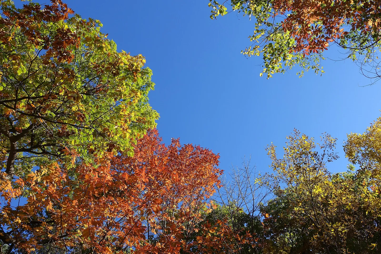
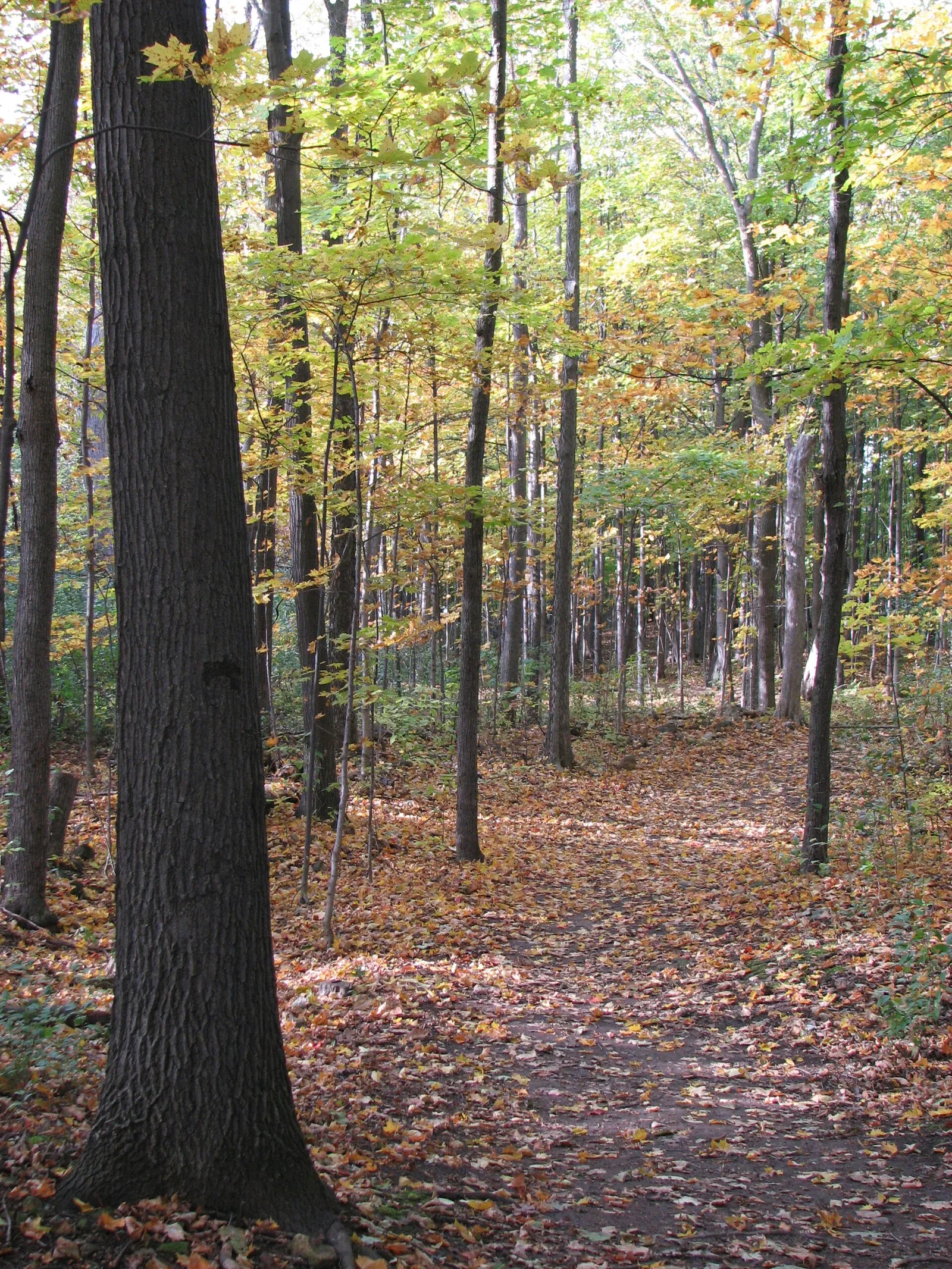
This is the mountain’s best season. The maples and oaks turn orange and red, and in the city the peak usually arrives around mid-October, later than in the Laurentians because of the urban heat island. Walk chemin Olmsted slowly, then continue into Notre-Dame-des-Neiges for more colour and fewer people. For the timing of the season across Quebec, see the best time to visit Montreal.
Winter
Snow transforms Mount Royal, and it is when locals use it most. The Beaver Lake pavilion rents skates, cross-country skis, snowshoes and snow tubes. The refrigerated rink on the lake is the most reliable outdoor ice in the city, and there are about 22 km of cross-country ski trails across the mountain, with snowshoe routes through the woods. The chemin Olmsted is a good snowshoe or winter walk, but the Peel stairs can be treacherous: wear boots with grip or a pair of slip-on crampons. Our Montreal in winter guide has the rest of the season’s outdoor options.
Three Walks on Mount Royal
The classic loop (about 2 hours)
Start at the corner of Peel and avenue des Pins. Climb the stairs to chemin Olmsted, then up to the Kondiaronk Belvedere for the view. Walk east along the summit paths to the cross, then back past the summit area and follow the paths north-west to Beaver Lake. From there, take the 11 bus down to Mont-Royal metro, or walk down chemin Olmsted to avenue du Parc and into the Plateau for a late lunch.
The Olmsted walk (about 2.5 hours)
Start at the George-Étienne Cartier monument on avenue du Parc and follow chemin Olmsted all the way up, taking in the views as they open. Stop at the Kondiaronk Belvedere, then continue on to Beaver Lake. Return the same way for an easy downhill stroll. This is the best walk for families and for anyone who likes a steady pace.
The mountain and the cemeteries (about 3 hours)
Take the 11 bus to Beaver Lake. Walk to the lookout for the view, then return towards Beaver Lake and enter Mount Royal Cemetery. Wander through to Notre-Dame-des-Neiges, then exit on the Côte-des-Neiges side and walk to Saint Joseph’s Oratory, which is free to enter. Finish at Côte-des-Neiges metro (Blue line). Check the cemetery gates’ hours before you set off.
Beyond the Mountain: Montreal’s Other Great Parks
Mount Royal is only the beginning. Montreal is an island in a river, with more than a dozen large parks, a network of nature parks on its edges, and urban beaches. These are the ones worth your time, and why.
| Park | Area | Getting there | Best for | Cost |
|---|---|---|---|---|
| Parc La Fontaine | Plateau Mont-Royal | Sherbrooke or Mont-Royal metro (Orange) | A stroll, a picnic, winter skating | Free |
| Parc Jarry | Villeray | De Castelnau or Parc metro (Blue) | Locals’ Sunday, near Jean-Talon Market | Free |
| Parc Jean-Drapeau | Île Sainte-Hélène and Île Notre-Dame | Jean-Drapeau metro (Yellow) | Views, the Biosphère, a beach, cycling the F1 track | Free; attractions extra |
| Lachine Canal | Old Port to Lachine | Lionel-Groulx or Charlevoix metro; BIXI | Cycling, running, kayaking | Free |
| Botanical Garden and Parc Maisonneuve | Hochelaga-Maisonneuve | Pie-IX metro (Green) | Gardens, Gardens of Light in autumn | Garden $25.50; park free |
| Île-de-la-Visitation | Ahuntsic, Rivière des Prairies | Bus from Henri-Bourassa metro (Orange) | A quiet riverside walk | Free |
| Cap-Saint-Jacques | Western tip of the island | Car or long bus ride | Beach, forest trails, a working farm | Free entry; some activities extra |
| Verdun Beach | Verdun | De L’Église metro (Green) | A free swim in summer | Free |
Parc La Fontaine
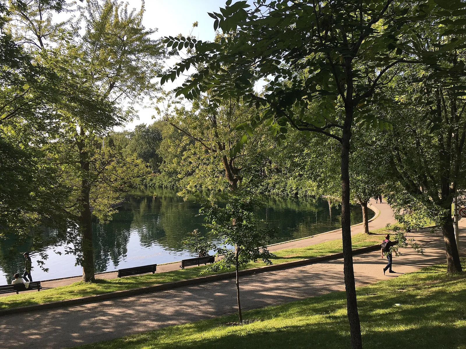
The Plateau’s main park is the one Montrealers stroll through with a coffee on the way to somewhere else. It has a long pond, big old trees, tennis courts and the open-air Théâtre de Verdure, which stages free performances in summer. In winter, the pond freezes over for skating. It lacks a big view, but it’s the best place to see everyday Montreal life at its most relaxed. Walk here from Sherbrooke or Mont-Royal metro and pair it with a wander through the Plateau’s side streets.
Parc Jarry
Up in Villeray, Parc Jarry is less pretty than La Fontaine and more local. Its big lawns fill with families, pick-up soccer games and picnickers on summer weekends, and its southern edge is home to IGA Stadium, which hosts the National Bank Open tennis tournament in summer. It is ten minutes’ walk from Jean-Talon Market, so buy your lunch there first.
Parc Jean-Drapeau
Parc Jean-Drapeau covers two islands in the St Lawrence: Île Sainte-Hélène, a natural island, and Île Notre-Dame, built for Expo 67. It is one stop from downtown on the Yellow line, and it is where Montreal goes to escape the city without leaving it.
On Île Sainte-Hélène, the Biosphère, the geodesic dome designed by Buckminster Fuller as the US pavilion at Expo 67, now houses an environment museum run by Space for Life ($25.50 for adults; closed Mondays from September). Paths along the shore give a fine view back across the river to Old Montreal and downtown. La Ronde amusement park is at the northern end. On Île Notre-Dame, the Circuit Gilles-Villeneuve, home of the Canadian Grand Prix, is open to cyclists, runners and in-line skaters when there’s no event on, and Plage Jean-Doré is a supervised beach on a lake in the middle of the island. Its 2026 season ran from 20 June to 7 September, with adult entry at $8.69 plus tax.
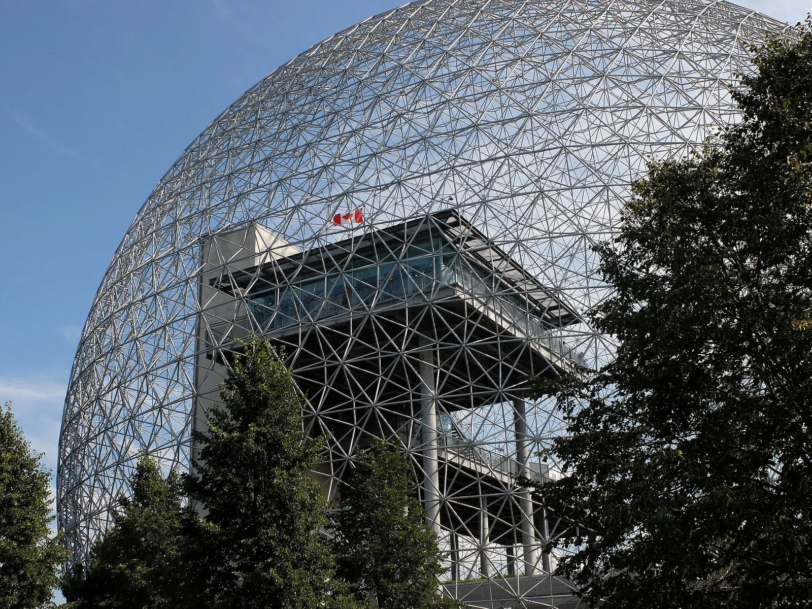
The park is also a festival site. Osheaga fills it every August and other big outdoor concerts take over the islands through summer, so check the festival calendar before you plan a quiet picnic there.
The Lachine Canal
The Lachine Canal runs 14.5 km from the Old Port to Lake Saint-Louis, and the flat, paved path along its banks is the most enjoyable cycling route in the city. Built in the 19th century to get ships around the Lachine Rapids, it powered Montreal’s industrial boom, and many of the old factories and warehouses along it are now lofts, offices and breweries.
The best stretch for visitors runs from the Old Port past Griffintown and Saint-Henri to Atwater Market, where you can stop for lunch. Keep going west and you pass through quieter residential areas to Lachine, with a waterfront park at the far end. Rent a BIXI bike from a station along the way: it costs $1.60 to unlock plus $0.21 a minute (or $0.36 a minute for an e-bike), plus tax, and the full season runs from 15 April to 15 November. In summer you can also rent kayaks and paddleboards on the canal itself.

The Botanical Garden and Parc Maisonneuve
Next to the Olympic Stadium in the east end, the Montreal Botanical Garden covers about 75 hectares with around 20 themed gardens and 10 greenhouses. The Japanese and Chinese gardens are the highlights. Admission is $25.50 for adults, and from September to October it is open 09:00 to 21:00. In autumn, the Gardens of Light lantern festival runs from 3 September to 1 November 2026, with timed tickets that include daytime entry. Next door, Parc Maisonneuve is a big, free, open park that’s good for a run or for a picnic after the garden.
The nature parks on the island’s edges
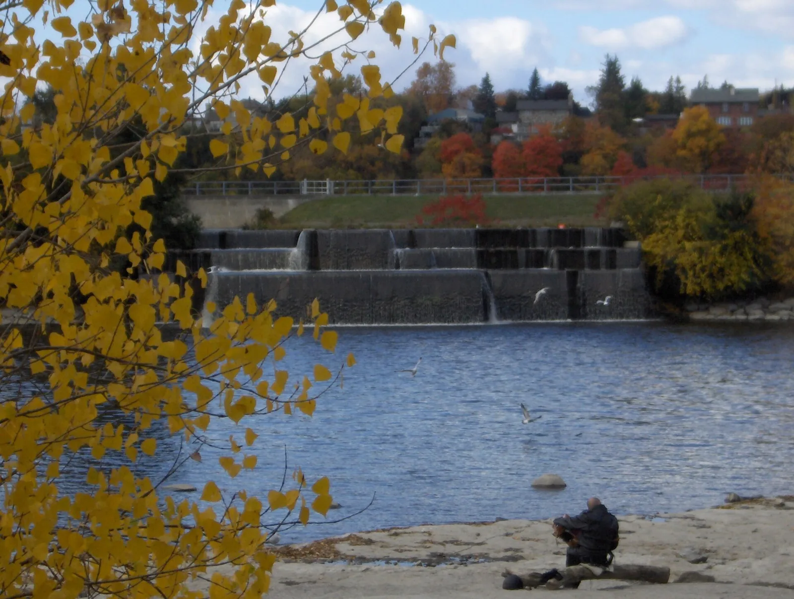
The City of Montreal runs a network of large nature parks around the island’s shores, and they feel far removed from downtown. Île-de-la-Visitation, on the Rivière des Prairies in Ahuntsic, has riverside paths, an old dam and the ruins of mills, and is one of the prettiest walks in the north of the island.
At the western tip of the island, Cap-Saint-Jacques is the largest of the nature parks, with a beach on the Lake of Two Mountains, forest trails and an ecological farm that families love. It’s a long trip without a car, but worth it on a hot day. Other parks in the network include Bois-de-l’Île-Bizard, with its boardwalks through wetlands, and Pointe-aux-Prairies at the eastern end of the island.
The Old Port waterfront
It’s not a park in the usual sense, but the Old Port is the longest stretch of open riverside in central Montreal: a couple of kilometres of promenade, lawns and piers between the St Lawrence and the historic streets. Walk it early in the morning before the crowds, or at sunset from the end of the Clock Tower pier, where you look across to Île Sainte-Hélène and the Jacques-Cartier Bridge. In summer the quays fill with food stalls, a zipline and the Grande Roue. Treat it as the green edge of Old Montreal rather than a destination in its own right, and combine the two in a single walk.
Parc des Rapides
In LaSalle, on the south shore of the island, the small Parc des Rapides looks straight out onto the Lachine Rapids, the churning stretch of river that stopped early explorers heading west. Herons and egrets nest on the islands offshore, and in summer you can watch rafts and jet boats bouncing through the waves. It’s on the cycle path along the river, so it is easy to add to a ride.
Outdoor Activities in and Around the City
Cycling
Montreal has hundreds of kilometres of bike paths, many physically separated from traffic, and cycling is one of the best ways to see the city from April to November. The Lachine Canal, the riverside path through Verdun and LaSalle, and a loop of Parc Jean-Drapeau are the classic rides. BIXI bikes are everywhere in season, and a reduced winter service runs from 16 November to 14 April with 234 stations and no e-bikes. Climbing Mount Royal by bike is hard work; most cyclists stick to the flat. For how BIXI works in detail, see getting around Montreal.
Swimming
Montreal is surrounded by water, but most of the river isn’t safe for swimming. Stick to the supervised spots. Verdun Beach, near De L’Église metro on the Green line, is free and has a buoyed calm-water area behind a rock jetty; the city describes it as the only safe place to swim in the river. Its 2026 season ran from 13 June to 30 August, from 10:00 to 19:00. Swimming can be suspended after heavy rain. Plage Jean-Doré and the beach at Cap-Saint-Jacques are the other options.
River surfing and rafting
One of Montreal’s odder sights is people surfing in the middle of the St Lawrence. A standing wave in the river near Habitat 67 is surfable all year by experienced surfers in thick wetsuits, and there are gentler waves with lessons for beginners further upstream by the Lachine Rapids. Rafting and jet-boat trips through the rapids run in summer. They’re thrilling and very wet; bring a change of clothes.
Kayaking and paddling
Kayaks, canoes and paddleboards can be rented on the Lachine Canal in summer, and paddling past the old industrial buildings is a gentle way to see the Southwest. For open water, the nature parks at the island’s edges and the national parks just outside the city are better bets.
Skating and winter sports
Beaver Lake on Mount Royal and Parc La Fontaine are the best-known outdoor rinks, and nearly every neighbourhood park floods a rink in winter. Note that the Old Port’s skating rink by the Bonsecours Basin has closed permanently, so ignore older guides that send you there. For cross-country skiing, Mount Royal’s 22 km of trails are the easiest to reach; for downhill, you need to head to the hills outside the city.
National Parks Near Montreal
Quebec’s provincial parks, run by Sépaq, are called national parks, and several are within an hour of the city. A daily access fee applies to each, and an annual Québec National Parks Card costs $51.50 for adults if you’ll visit several.
- Parc national des Îles-de-Boucherville: a group of islands in the St Lawrence just across from Montreal’s east end, with flat cycling, canoe routes between the islands and wildlife. The closest real nature escape.
- Parc national du Mont-Saint-Bruno: forested hills and lakes on the South Shore, with hiking in summer and cross-country skiing in winter.
- Parc national d’Oka: a long sandy beach on the Lake of Two Mountains, popular on summer weekends, plus trails and a Calvary hike.
- Parc national du Mont-Tremblant: 1,510 km² of lakes, rivers and mountains about 90 minutes north, for serious hiking and canoeing.
All of these are easiest by car. For how to fit them into a trip, see our day trips from Montreal.
Where to Stay Close to the Green Spaces
If walking in parks is a big part of your trip, base yourself accordingly. The Plateau puts you between Mount Royal and Parc La Fontaine, with chemin Olmsted’s starting point a short walk from most of its streets and the Sunday tam-tams on your doorstep. Downtown, especially the streets around McGill and the top of Peel, is the closest base for the Peel stairs, and it keeps the museums and shops within reach on a rainy day.
Cyclists and runners should look at Griffintown and Saint-Henri, both on the Lachine Canal, where you can be on the towpath within minutes of leaving your door and Atwater Market is your local grocer. Old Montreal gives you the Old Port promenade and the quickest route to Parc Jean-Drapeau via the Yellow line from Berri-UQAM. For the pros and cons of each area, including prices and noise, read our guide to where to stay in Montreal. If you’re arriving by air, the Montreal airport guide explains which bus route is quickest for each of these neighbourhoods.
A green first day
Here’s how we’d spend a first fine day with an outdoor bias. Start with a bagel in Mile End, then walk down to avenue du Parc and up chemin Olmsted to the Kondiaronk Belvedere by mid-morning. Cross the summit to Beaver Lake, take the 11 bus down to Mont-Royal metro and have lunch in the Plateau. In the afternoon, ride the Orange line to Lionel-Groulx, pick up a BIXI and cycle the Lachine Canal to Atwater Market and back towards the Old Port. Finish with dinner in Old Montreal and, if you still have the legs, a walk along the river at dusk.
Practical Tips for Mount Royal and the Parks
- Parking: the mountain’s five paid lots, at Beaver Lake, Maison Smith and the Camillien-Houde lookout, are open from 06:00 to midnight (the Camillien-Houde lot until 23:00). They fill up fast on fine weekends; the bus is often easier.
- Alcohol: allowed in Montreal’s parks with a meal. Leave glass bottles at home.
- Dogs: must be on a leash, and are not allowed in some areas.
- Bring water: with the chalet closed, there are fewer places to refill at the top of the mountain.
- After dark: the lookout is popular at night and generally safe, but stick to the main lit paths and walk down with others.
- Winter grip: the stairs and steeper paths ice over. Slip-on crampons cost little at outdoor shops and make a big difference.
- Tick season: ticks are present in wooded areas around Montreal from spring to autumn. Stay on paths and check yourself afterwards.
- Plan the day: pair the mountain with the Plateau or Côte-des-Neiges. Our Montreal itinerary slots it into a first visit.
Frequently Asked Questions
How long does it take to walk up Mount Royal?
From downtown, the Peel stairs get you to the Kondiaronk lookout in about 20 to 30 minutes of steep climbing. The gentler chemin Olmsted, starting from the George-Étienne Cartier monument on avenue du Parc, takes 45 minutes to an hour. If you’d rather not climb, take bus 11 from Mont-Royal metro to near Maison Smith and walk 10 to 15 minutes to the lookout.
Is Mount Royal free to visit?
Yes. Entry to Mount Royal Park, the lookouts, the trails and the tam-tams is free, and so is Saint Joseph’s Oratory on the mountain’s slope. You pay only for extras: parking in one of the five paid lots, rentals such as skates and snowshoes at the Beaver Lake pavilion, rowboats in summer, and the bus fare of $3.75 if you ride up.
Is the Mount Royal Chalet open?
Not at the moment. In September 2026 the park’s official site listed the Mount Royal Chalet as closed during excavation work on chemin Olmsted, and warned that construction was hindering access to the Kondiaronk Belvedere. The lookout can still be reached on foot by chemin Olmsted or the Peel entrance stairs. Check the conditions page at lemontroyal.qc.ca on the day you go.
When are the tam-tams on Mount Royal?
The tam-tams take place every Sunday afternoon from May to September, around the George-Étienne Cartier monument at the foot of Mount Royal on avenue du Parc. There is no schedule, stage or ticket: drummers and crowds start gathering from early afternoon on fine days and stay until evening. They’re at their busiest on hot Sundays in June and July.
What is the best time of year to visit Mount Royal?
Mid-October is hard to beat, when the maples on the mountain turn orange and red. Summer brings picnics, the tam-tams and long evenings at the lookout. Winter is excellent for skating on the refrigerated Beaver Lake rink, cross-country skiing on 22 km of trails and snowshoeing. Spring is the quietest season but paths can be muddy until May.
Can you skate on Beaver Lake in winter?
Yes. Beaver Lake on Mount Royal has a refrigerated outdoor rink, which keeps the ice skateable more reliably than natural ponds. Skates, cross-country skis, snowshoes and snow tubes are rented from the Beaver Lake pavilion. The 11 bus from Mont-Royal metro stops nearby. Don’t go looking for the Old Port rink: it has closed permanently.
Where can you swim in Montreal?
Stick to supervised sites. Verdun Beach, near De L’Église metro, is free and was open daily from 10:00 to 19:00 from 13 June to 30 August in 2026. Plage Jean-Doré on Île Notre-Dame charges $8.69 plus tax for adults, and Cap-Saint-Jacques has a beach at the island’s western tip. Swimming elsewhere in the river is unsafe.